Bear Attempts to Cross Highway 46 Times
A young male grizzly bear has been tracked attempting to cross a busy highway in western Montana 46 times over a period of 53 days.
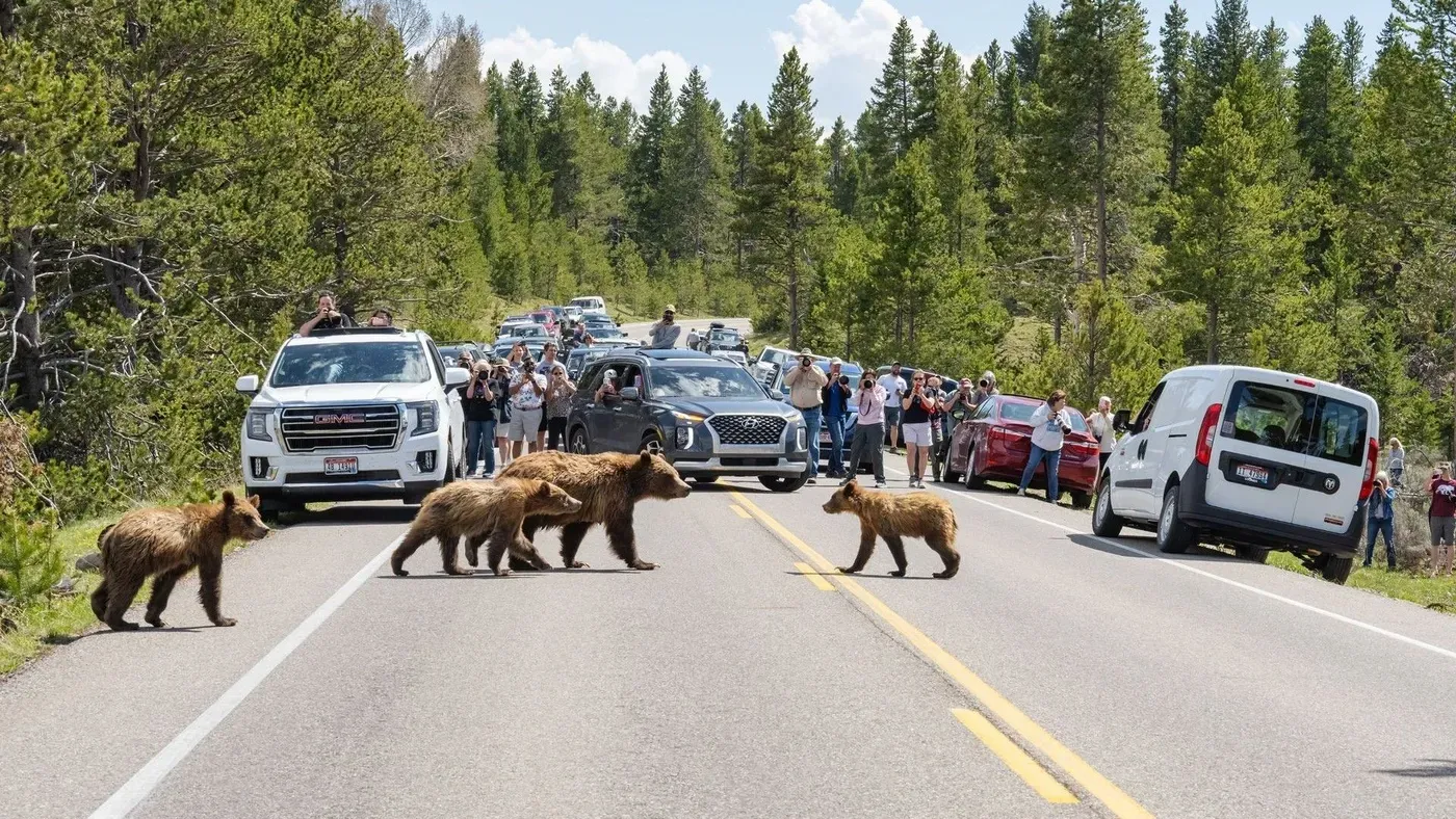
A young male grizzly bear nicknamed "Lingenpolter has been tracked attempting to cross a busy highway in western Montana 46 times over a period of 53 days between fall 2020 and spring 2021.
The bear's movements were recorded using high-resolution GPS tracking, showing him moving parallel to four lanes of traffic before bouncing off the highway like a pinball as he searched for a gap.
Lingenpolter eventually managed to cross the highway, possibly by slipping under a river bridge.
However, his journey highlights the challenges faced by wildlife when attempting to navigate busy roads, according to Cecily Costello, a research wildlife biologist at Montana's Department of Fish, Wildlife and Parks.
Costello notes that it is easy to imagine the difficulty experienced by Lingenpolter in trying to reach the other side of the highway.
A map has been created showing all the places where Lingenpolter attempted to cross the road before successfully making it across.
This map provides valuable insight into the bear's behavior and attempts to navigate a busy highway.
In May, another grizzly bear was not so lucky when it tried to cross near one of Lingenpolter's previous attempts.
The vast wilderness between Yellowstone and the Yukon is considered one of the most intact wild mountain regions globally, playing a crucial role in bear migration.
However, as human development and infrastructure expansion continue to fragment this landscape, ensuring connected pathways for grizzly bears has become increasingly challenging.
These majestic creatures roam across diverse terrain, from high-elevation alpine habitats to mid-mountain slopes and low valley bottoms, highlighting the need for safeguarding their movement to also protect passageways for coexisting species like wolverines, mountain goats, elk, and bighorn sheep.
Researchers are working to understand why, where, and when grizzlies move, as well as what factors halt their progress.
This understanding is essential in maintaining connected pathways across the fragmented landscape, which would also benefit other species.
To grasp how bears navigate this complex terrain, researchers have been using GPS collars on grizzly bears to track their movements, providing valuable insights into their behavior and decision-making processes.
By analyzing tracking data, scientists are starting to build a detailed picture of where bears go and why they make certain choices.
Wild grizzlies tend to steer clear of humans, but when food is scarce during winter months, some bears may venture into areas inhabited by people.
In these situations, unfortunately, many bears end up getting killed.
According to researchers, the ability of a bear to navigate its surroundings and avoid danger is largely shaped by its individual personality traits.
Some bears are more cautious than others, while others may be more impulsive or reckless.
For instance, a young male grizzly named Lingenpolter made multiple attempts to cross Interstate 90 in western Montana before finally succeeding on his forty-sixth try.
This suggests that some bears may not inherit the best navigation skills from their mothers, and instead develop their own unique strategies for survival.
The land purchase made by Michael Proctor was a pivotal moment in securing connectivity corridors for grizzlies in southeastern British Columbia's Creston Valley.
Proctor invested 10,000 Canadian dollars of his own money to buy crucial land that would link the South Selkirk Mountains and Purcell Mountains, facilitating the movement of bears between these two ranges.
This purchase marked the beginning of a concerted effort by Proctor and other scientists to establish safe corridors for grizzlies in the region. They collaborated with trusts to acquire additional land parcels, build fences, and create pathways for bears to move north-south and east-west.
These connectivity corridors allowed bears like Captain Hook to migrate into the South Selkirks and breed successfully with multiple females. The outcome was impressive, with nine immigrant bears producing 27 new offspring within a relatively short period of time by 2021.
The success of these efforts highlights the importance of gene flow and connectivity in maintaining healthy bear populations. Proctor's statement emphasizes that safeguarding corridors is crucial for ensuring the long-term survival of grizzlies in the region.
In addition to land purchases, researchers have been studying how bears navigate human-dominated landscapes. Servheen's work in northwest Montana has shed light on the challenges faced by grizzlies when crossing busy highways like Highway 2.
Despite their best efforts to avoid danger, many bears are forced to cross roads under the cover of darkness, and those that do often cluster in specific sections where overpasses or underpasses have been constructed.
As it turns out, bears' exceptional memory for food sources is not enough to ensure their safety when crossing roads, according to conservationists. While they can remember where to find food, there's no reward in a bear's brain for navigating roads safely.
In fact, the opposite is true - failing to cross roads safely comes with a fatal penalty. This means that conservationists cannot rely solely on bears' memory to avoid danger zones.
To mitigate this risk, wildlife experts are building fencing along highways to guide animals into designated underpasses or overpasses. However, simply constructing these crossings is not enough. The surrounding land must also be designed to allow safe passage for the animals.
If the adjacent areas do not provide a secure route, the entire effort becomes futile - essentially creating a bridge to nowhere". This highlights the complexity of designing effective wildlife corridors.
To address this challenge, researchers are developing innovative methods to predict where bears are likely to travel. One approach involves using data from GPS collars on individual grizzlies to create detailed maps of their movement patterns.
By combining these data with computer simulations, scientists can recreate a virtual environment that mimics the real-world terrain. This allows them to test various scenarios and observe how virtual bears navigate different landscapes.
Using this model, researchers have been able to predict how grizzly bears might recolonize specific ecosystems, such as the Bitterroot region of Idaho and Montana.
Understanding where grizzly bears are likely to end up is crucial for addressing potential challenges they may face in fragmented wilderness areas.
The data collected suggests that human contact or transportation infrastructure poses the greatest barrier to grizzly bear survival across the entire Yellowstone-to-Yukon region.
Studies conducted between 1989 and 2015 indicate that humans directly or indirectly caused between 77% and 90% of grizzly bear deaths, with hunting, managed kills in urban areas, and road and rail collisions being major contributors.
Bears often attempt to avoid human-dominated areas but may seek them out due to the availability of food sources, which can lead to conflicts when they interact with people who have settled in these areas for recreational purposes or other reasons.
To mitigate human-bear conflict, research has shown that grizzly bears tend to steer clear of busy cycling and hiking trails, highlighting the importance of minimizing human presence in sensitive ecosystems.
Facts based on reporting originally published by Live Science.
You may republish this story, in full or in part, if you credit News Central Site and link to it (licence CC BY 4.0). Photos are not included.