Hyperspectral Mapping Tool Unveiled in Australia
A new hyperspectral map has been created using satellite imaging technology to pinpoint areas rich in mineral deposits across the Australian continent.
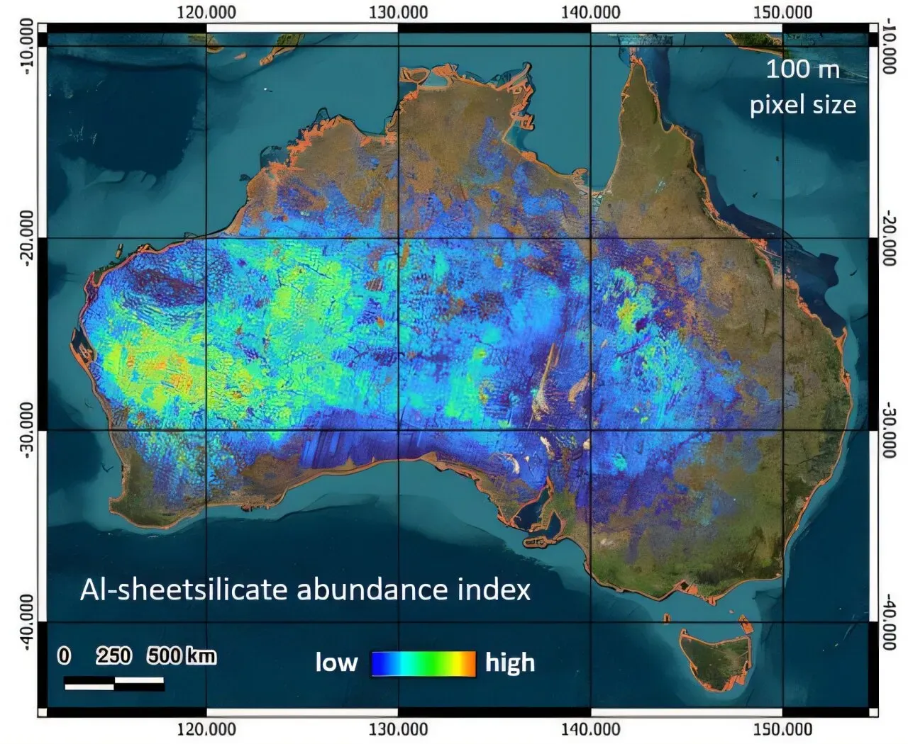
A groundbreaking tool has been unveiled in Australia to help unlock the country's vast mineral wealth. The innovative technology uses satellite imaging to create detailed maps of the continent's surface, pinpointing areas rich in deposits. This new hyperspectral map is a game-changer for Australian mining industries.
The CSIRO, Australia's national science agency, has developed this cutting-edge tool using satellites that capture reflected light across over 200 narrow spectral bands. In contrast, previous satellite images were limited to just 14 bands. This significant improvement in imaging technology allows researchers and miners to identify mineral deposits with greater precision and accuracy.
This new hyperspectral mapping capability is crucial as Australia seeks to increase its supply of critical minerals for clean energy technologies, advanced manufacturing, and national resilience. According to Dr. Sandra Occhipinti, a research director at the CSIRO, this technology is like "the difference between listening to 14 notes on a piano and hearing a full orchestra".
The technology has allowed researchers to create a comprehensive map of Australia's mineral wealth, providing unprecedented detail on the continent's geological composition.
Remote sensing from satellites has enabled the creation of this detailed map, which would have been impossible through traditional field and laboratory measurements due to their limited scale. This new approach has the potential for far-reaching applications beyond mineral exploration, including agriculture and environmental monitoring.
The CSIRO team developed a sophisticated system to combine data from three satellite missions: PRISMA, EnMAP, and EMIT. They processed hundreds of terabytes of information, overcoming challenges related to cloud cover and data quality to build a comprehensive map of Australia's mineral resources.
The comprehensive map of Australia's mineral resources has been made available to the public through CSIRO's XT Portal, where it can be downloaded and viewed for free.
This achievement is part of a broader effort by CSIRO to develop innovative methods for converting satellite data into practical geoscience information that benefits not only the mineral resources sector but also environmental and land management decisions. The technology has the potential to unlock new opportunities for Australia's resource development while supporting more informed decision-making.
The successful creation of this map is a testament to the power of advanced satellite imagery in providing valuable insights into the country's mineral wealth, paving the way for further research and exploration.
Facts based on reporting originally published by Phys.org.
You may republish this story, in full or in part, if you credit News Central Site and link to it (licence CC BY 4.0). Photos are not included.